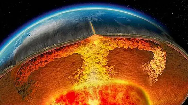
Numerous maps have been discovered depicting our planet as it was before the last ice age. Many people claim that before written history, extremely advanced ancient civilizations existed on Earth and
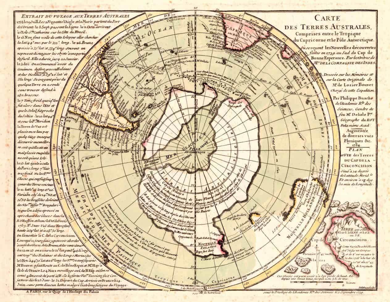
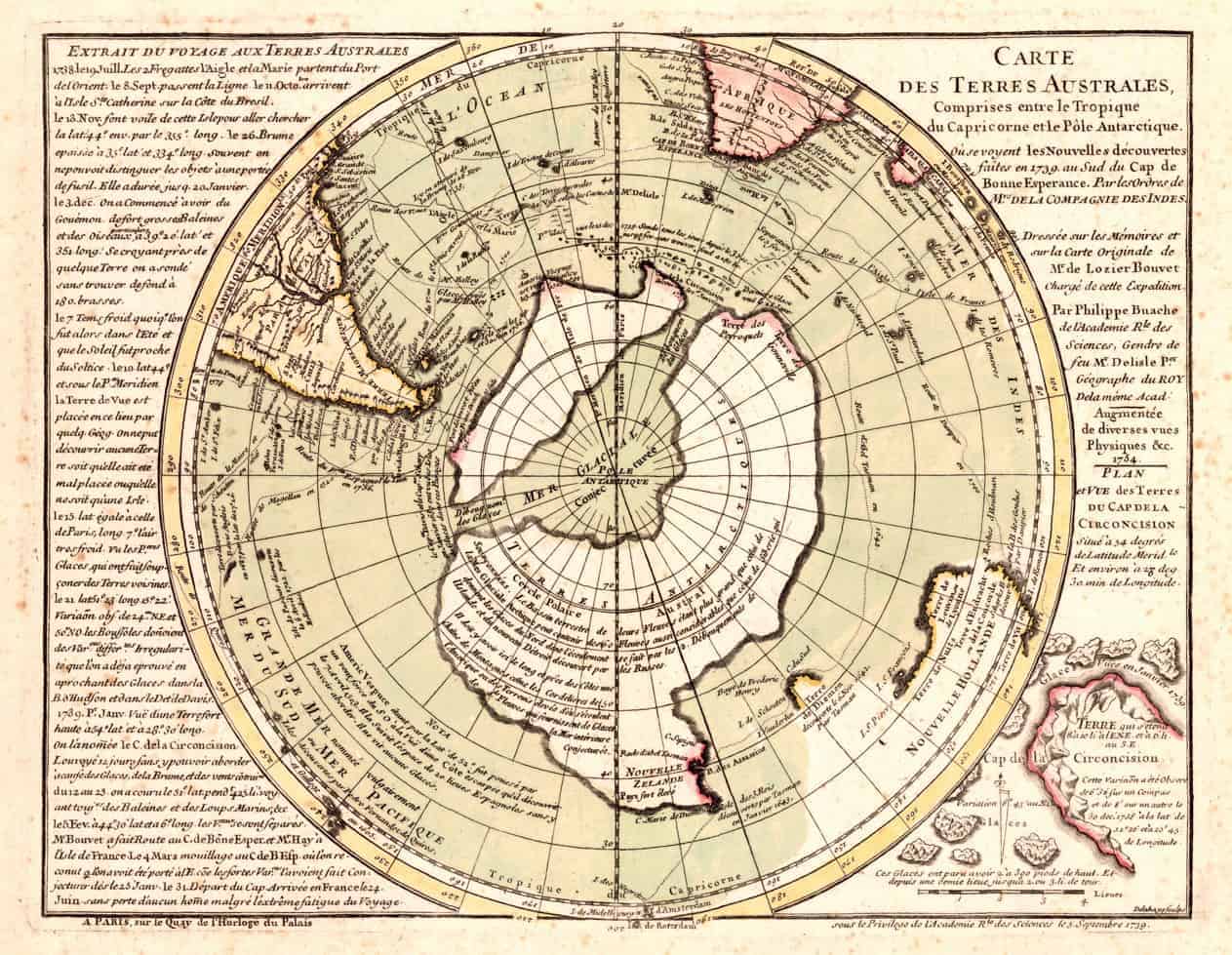 The correct name of the map is “Carte des Terres Australes comprises entre le Tropique du Capricorne et le Pôle Antarctique où se voyent les nouvelles découvertes faites en 1739 au Sud du Cap de Bonne Esperance" which translated to English reads: "Map of the Southern Lands contained between the Tropic of Capricorn and the Antarctic Pole, where the new discoveries made in 1739 to the south of the Cape of Good Hope may be seen".
Many people claim that the Bouche Map also accurately positioned the Canary Island. The map issued in 1737 also displays the correct outline of the underwater plateau on which the islands are located. This means that the source of the map used to create it is based on a survey of the shape before glaciers melted and ocean levels rose. Even more interesting is the fact that the Buache Map depicts the waterway which divides the continent of Antarctica into two landmasses.
Claims about the Buache Map and that it depicts the continent of Antarctica Ice-Free are said to have its origins Charles Hapgood’s 1966 book, Maps of the Ancient Sea Kings. Since then, many have claimed that together with other ancient maps, the Buache map was created based on far older maps which are said to have been created by a highly developed ancient civilization. However, many argue that this is incorrect. Today, its difficult to imagine if or not, the Buache map accurately represents the subglacial coastline of Antarctica. Furthermore, many argue that the map itself indicate as to how it was created, making no reference to far older maps.
If we observe the map carefully, we will find that two important words are written on the map: conjecturée (conjectured) and soupçonnée (suspected) are located in the regions depicting the southern continent. (The exact text, written on the map can be found here, translated from French).
The correct name of the map is “Carte des Terres Australes comprises entre le Tropique du Capricorne et le Pôle Antarctique où se voyent les nouvelles découvertes faites en 1739 au Sud du Cap de Bonne Esperance" which translated to English reads: "Map of the Southern Lands contained between the Tropic of Capricorn and the Antarctic Pole, where the new discoveries made in 1739 to the south of the Cape of Good Hope may be seen".
Many people claim that the Bouche Map also accurately positioned the Canary Island. The map issued in 1737 also displays the correct outline of the underwater plateau on which the islands are located. This means that the source of the map used to create it is based on a survey of the shape before glaciers melted and ocean levels rose. Even more interesting is the fact that the Buache Map depicts the waterway which divides the continent of Antarctica into two landmasses.
Claims about the Buache Map and that it depicts the continent of Antarctica Ice-Free are said to have its origins Charles Hapgood’s 1966 book, Maps of the Ancient Sea Kings. Since then, many have claimed that together with other ancient maps, the Buache map was created based on far older maps which are said to have been created by a highly developed ancient civilization. However, many argue that this is incorrect. Today, its difficult to imagine if or not, the Buache map accurately represents the subglacial coastline of Antarctica. Furthermore, many argue that the map itself indicate as to how it was created, making no reference to far older maps.
If we observe the map carefully, we will find that two important words are written on the map: conjecturée (conjectured) and soupçonnée (suspected) are located in the regions depicting the southern continent. (The exact text, written on the map can be found here, translated from French).
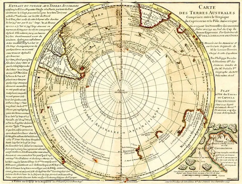 The other map which does not display Antarctica
This indicates, according to some, that the landmass was not seen on older maps, but that the continent was hypothesized by Buache himself. The truth is that the Buache Map is not the only one of its kind. Today, numerous other ancient maps apparently depict geographical features on our planet that would have been tough for ancient explorers to chart. Whether or not some of these maps were created with the help of far older maps is a mystery. However, it is fascinating to read about them since they offer complete details about ancient maps created in the distant past. Many people firmly believe that the existence of the Buache Map, the Piri Ries map, and other ancient maps prove that in the distant past, ancient explorers had an extremely well-developed cartography system comparable in precision to the one we have today. The maps can be interpreted as evidence that ancient mankind knew the exact shape and size of the Earth, contrary to popular beliefs, and used spherical trigonometry, and precise and elaborate mathematical calculations, as if thousands of years ago, an unknown civilization undertook a global-scale project of mapping the entire planet like no one has ever done before. What do you think?
Reference: http://www.geographicus.com/P/AntiqueMap/Antarctica-gentlemansmagazine-1763 http://www.ancient-origins.net/artifacts-other-artifacts/buache-map-controversial-map-shows-antarctica-without-ice-005647 https://www.forbiddenhistory.info/?q=node/69
 Unexplained
India: Footprints embedded in rock, evidence of ancient astronauts?
Are the footprints embedded in rock in India evidence of ancient astronauts? A village in central India has fueled discussions on numerous social networks about the discovery of a mysterious set of "f
 Unexplained
A researcher Claims to Have Found a 55.000-year-old Artifact Made of Oxygen
In 1990 an Italian "geologist" named Angelo Pitoni was visiting Sierra Leone, in the vicinity of the border with Guinea Conakry, to verify if a certain region of the country known as Kono was indeed,
 Unexplained
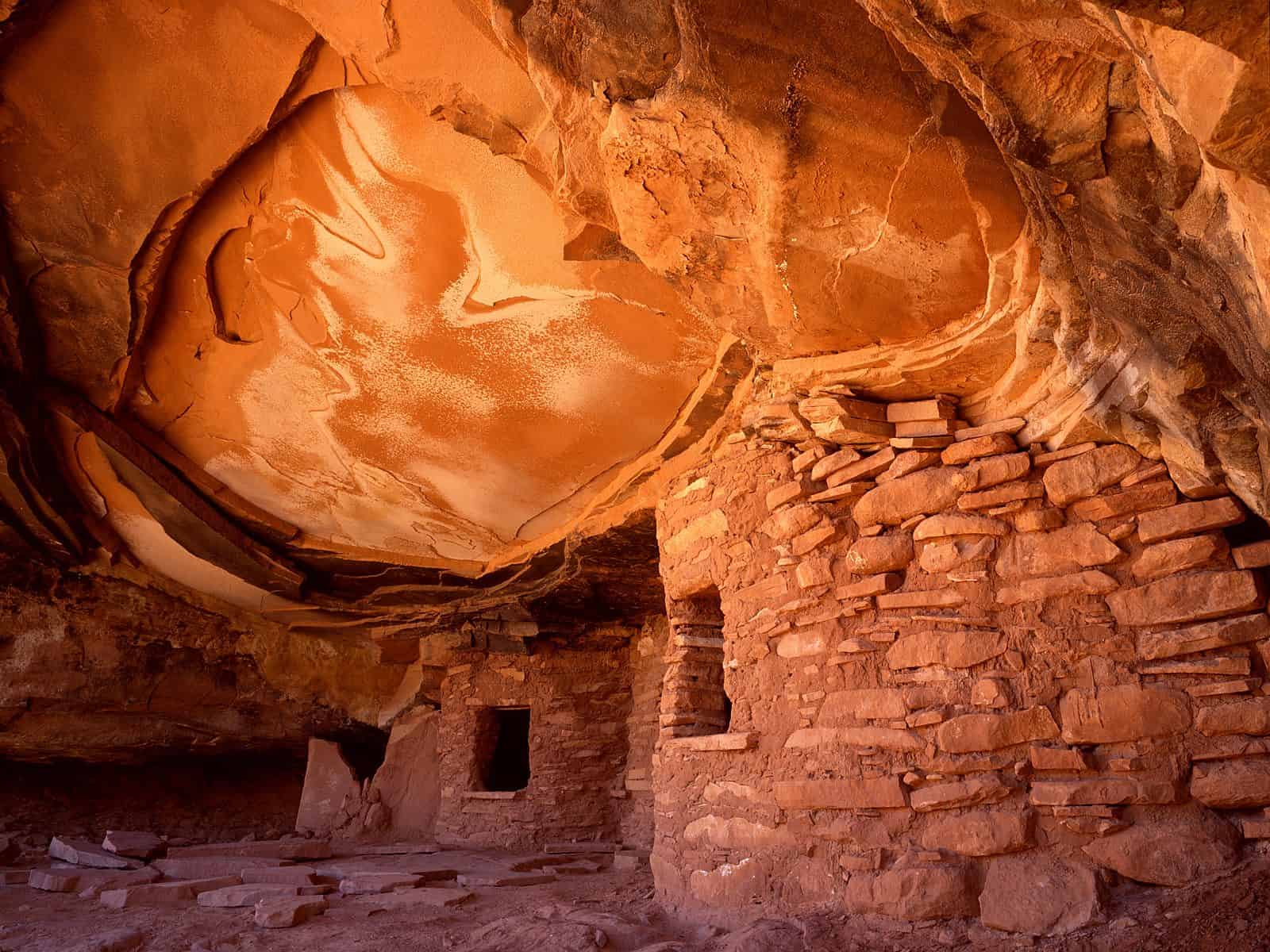
The unanswered mysteries of the Anasazi
The great American southwest is considered by many as a place of extremes, ancient people, spirits and legends that even today, inhabit the region. Thousands of years ago, an ancient culture flourishe