Home Blog Page 83

Rare, ancient maps show how thousands of years ago, an advanced civilization mapped the Earth

0

YouTube Video Here: https://www.youtube.com/embed/Qt2GYyGTXTs?feature=oembed&enablejsapi=1

Countless maps suggest that before written history, ancient explorers had an extremely well-developed cartography system comparable in precision to the one we have today proving that ancient mankind knew the exact shape and size of the Earth, contrary to popular beliefs, and used spherical trigonometry, precise and elaborate mathematical calculations, as if thousands of years ago an unknown civilization undertook a global-scale project of mapping the entire planet like no one has ever done before.

Have you ever considered the possibility that thousands of years ago, before the rise of some of the greatest ancient civilizations on Earth; the Aztecs, Maya, Olmec, Inca, Egyptian, Chinese, Sumerian etc., a much older, and far more advanced civilization existed on our planet?

Earth’s history is shrouded in mystery. The giant puzzle we call origin of life is filled with gaps mainstream scholar have been unable to fill. Adding fuel to the mystery of our history are countless discoveries that have been made around the globe.

In addition to curious monuments, megalithic sites, and ‘out of place artifacts’, experts have come across dozens of maps that suggest an extremely advanced civilization—capable of great feats—existed before the rise of some of the greatest ancient civilizations on Earth.

Some refer to this civilization—however, I’m more inclined to think that many civilizations could have existed—as the antediluvian predecessor of the most important ancient cultures on Earth.

How can you explain—from a logical point of view— prehistoric, ancient maps, depicting regions of our planet like Antarctica without ice?

By doing some simple research you’ll come across not one, but countless maps that depict the same thing: The continent of Antarctica presumably without ICE.

But… how is this even possible? We’ve only ‘found’ Antarctica recently. So how can there be maps of the continent depicting it free of ice?

According to experts, Antarctica separated around 160 million years ago from the Gondwana supercontinent, beginning to cool down again. By 23 million years ago, Antarctica was mostly icy and for the last 15 million years, it has been a frozen desert under a thick ice sheet.

Today, scientists estimate that 98% of Antarctica is covered by the Antarctic ice sheet, a sheet of ice averaging at least 1.6 km (1.0 mi) thick. The continent has about 90% of the world’s ice (and thereby about 70% of the world’s fresh water).

An ancient global-scale ‘mapping project’
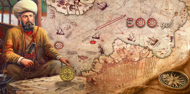
PiriReis - Rare, ancient maps show how thousands of years ago, an advanced civilization mapped the Earth
A look at the ancient Piri Reis map

Piri ReisThe fact that there are maps that depict Antarctica free of Ice, and other parts of the world that were not discovered until recently gives rise to MANY theories—some of them somewhat controversial.

Interestingly, many authors—including myself—will venture out and say that these maps may very well prove that in the distant past, ancient explorers had an extremely well-developed cartography system comparable in precision to the one we have today.

These maps could also ‘prove’ that ancient mankind knew the exact shape and size of the Earth, contrary to popular beliefs, and used spherical trigonometry, precise and elaborate mathematical calculations, as if thousands of years ago an unknown civilization undertook a global-scale project of mapping the entire planet like no one has ever done before. The result: numerous ancient maps that according to many prove our history is not what we’ve been told.

The Zeno Map. Published around 1380, the enigmatic maps accurately depicts the coasts of modern-day countries such as Norway, Sweden, Denmark, Germany, and Scotland. This ancient map also happens to depict—somehow—the EXACT latitude and longitude of a number of islands on our planet.

The Camerio map, created in 1502 uses a spherical grid, even though people in the middle ages still believed our planet was in fact… flat.

The Iehudi Ibn ben Zara map, drawn in 1487 displays remnants of glaciers in Britain. The map also includes extremely detailed depictions of islands in the Mediterranean and Aegean seas. Today, these islands still exist, but due to rising water levels, these are now underwater.

The Hadji Ahmed map, published in 1559, shows incredibly accurate delineations of the western coast of Northern America and Antarctica.

The Buache map—created around 1737— is believed to be the result of much more ancient maps. This chart depicts Antarctica well before the ‘icy’ continent was in fact discovered. Interestingly, like many other ancient maps, this too accurately illustrates Antarctica without ice.

Another shocking map is the King Jaime World Chart. Created in 1502, the map accurately depicts parts of the Sahara Desert displaying it much differently than it is today: with fertile land, huge lakes rivers and what appear to be ancient cities.

The Oronce Finé World Map created in 1534, is an early cordiform chart which displays features of Antarctica when the continent was not covered by Ice.
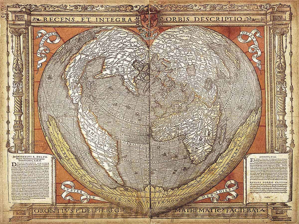
OronceFine - Rare, ancient maps show how thousands of years ago, an advanced civilization mapped the Earth
1534: The Oronce Finé World Map. An early cordiform projection which features the Antarctic continent splayed along its southern edge some 300 years before it is believed to have been discovered. An inscription spans the width of the continent, “Southern land newly discovered, but not yet fully explored.”

Just as the Buache map, the Piri Reis Map—one of the most famous ancient charts—is supposedly a collection of even older maps, displaying the correct coastline of Antarctica as it was under the ice. The map was composed around 1520 and in addition to displaying Antarctica without ice, it accurately depicts the geography of the American Continent with such a precision that it looks as if it was put together with the aid of aerial photography.

Is it possible that all of the above maps are the result of an advanced ancient civilization that somehow managed to map the entire planet thousands of years ago—perhaps before the last ice age?

If so, who was this mysterious civilization and does this provide enough ground to venture out and say advanced ancient civilization—like Atlantis—may have existed on Earth, terns of thousands of years ago?


Reference:

Six Ancient Maps that should not exist according to mainstream Scholars

Evidence suggests the Sahara desert is not a natural formation

0

sahara - Evidence suggests the Sahara desert is not a natural formation
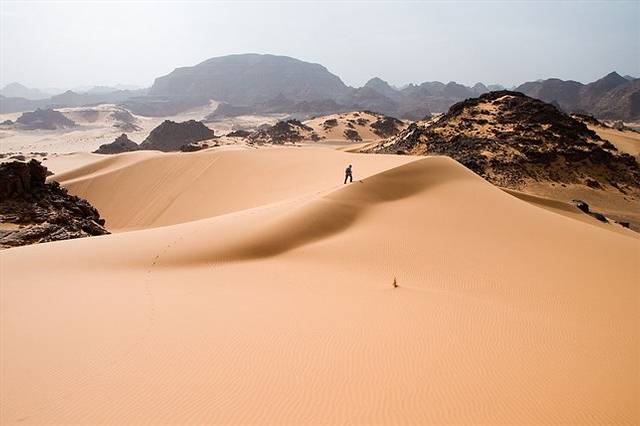
Tadrart Acacus desert in western Libya, part of the Sahara. Image Credit: Wikipedia

So who ‘created’ the Sahara desert?

The Sahara, the largest desert in the world, was not always the arid region we see today. More than 10,000 years ago, the gigantic expanse of dunes we see today was in fact a green meadow ‘flooded’ with lakes.

The drastic change in the landscape was often attributed to an alteration in Earth’s orbit, but a new hypothesis suggests that it was humans who were behind the transition of the Sahara to the inhospitable desert we see today.

A new study concluded that our species played a fundamental role in the creation of the desert.

A new article published in Frontiers in Earth Science by archeologist David Wright of Seoul National University defies the conclusions of most of the studies to date that indicate changes in Earth’s orbit or natural changes In vegetation as major driving forces that turned the Sahara into a massive desert.

To test his hypothesis, Wright reviewed the archaeological evidence documenting the first grazing occurrences throughout the sub-Saharan region and compared this to records showing the spread of scrub vegetation, an indicator of ecological change towards desert conditions.

According to reports, it all began some 8,000 years ago when African neolithic communities started experimenting with pastoral agriculture near the river Nile. This technique gradually moved westwards and as communities spread, they introduced large quantities of livestock and an increasing amount of vegetation was removed to graze and house them.

This massive change reduced the ground to scrub which left almost no protection from the sun’s rays. This increased the amount of sunlight which was reflected off our planet’s surface, which changed atmospheric conditions.

According to experts, this caused a reduction in monsoon rainfall which in turn led to further desertification and vegetation loss.

Throughout the years, this cycle eventually spread out ‘terraforming’ an area as big as the US into the desert we see today.

Much remains to be done to fill the gaps, but Wright believes there is a lot of information hidden beneath the surface: “There were lakes everywhere in the Sahara at this time, and they will have the records of the changing vegetation, ” Dr. David Wright said in a statement.

“We need to drill down into these former lake beds to get the vegetation records, look at the archaeology, and see what people were doing there. It is very difficult to model the effect of vegetation on climate systems. It is our job as archaeologists and ecologists to go out and get the data, to help to make more sophisticated models.”

Despite taking place several thousand years ago, the implications of humans who are responsible for environmental and climatic degradation are easy to see.

With approximately 15 percent of the world’s population living in desert regions, Wright highlights the importance of the finding: “The implications of how we change ecological systems have a direct impact on whether humans can survive indefinitely in arid environments.”

Video: Buzz Aldrin confirms seeing UFOs on the Moon

1

YouTube Video Here: https://www.youtube.com/embed/OnxbAuyFF3c?feature=oembed&enablejsapi=1

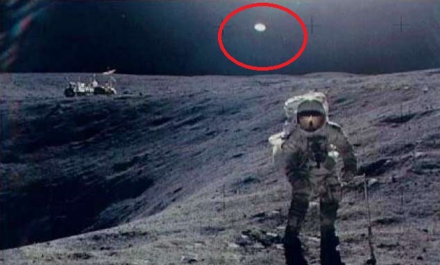
“I saw this illumination that was moving with respect to the stars. We were smart enough to not say, “Houston’ there’s a light out there following us! So technically, it becomes an unidentified flying object”


In a video uploaded to YouTube titled “EXCLUSIVE: Buzz Aldrin Confirms UFO Sighting in Syfy’s ‘Aliens on the Moon,” an American engineer and former astronaut, who as the Lunar Module Pilot on Apollo 11 was one of the first two humans to land on the Moon has made incredible statements in regards of UFOs.


Ufo-the-moon- - Video: Buzz Aldrin confirms seeing UFOs on the Moon


This, however, isn’t a surprise since in the last couple of years numerous individuals—former astronauts, military officers, former NASA employees, and others have come forward lifting the secrecy off the UFO and alien phenomenon.

According to the exclusive on Sighting in Syfy’s ‘Aliens on the Moon, Neil Armstrong also switched to the “medical channel and spoke directly with the chief medical officer” and is quoted as saying, they’re here, they’re parked on the side of the crater – they’re watching us!

In addition to Buzz Aldrin, Armstrong has also spoken out about UFOs.

During an interview about the Apollo 11 mission, the former astronaut supposedly said that beings that occupied the UFO made very clear their displeasure of the human’s arrival on the moon’s surface:

Armstrong: It was incredible … of course, we had always known there was a possibility … the fact is, we were warned off. There was never any questions then of a space station or a moon city.

Interestingly, Eugene Cernan, commander of Apollo 17 said in a Los Angeles Times article in 1973: “…I’ve been asked (about UFOs) and I’ve said publicly I thought they (UFOs) were somebody else, some other civilization.”

One of the best quotes backing up those claims comes from Scott Carpenter— an American naval officer and aviator, test pilot, aeronautical engineer, astronaut, and aquanaut: “At no time, when the astronauts were in space were they alone: there was a constant surveillance by UFOs.”

On Apollo 11 in route to the Moon, I observed a light out the window that appeared to be moving alongside us. There were many explanations of what that could be, other than another spacecraft from another country or another world – it was either the rocket we had separated from, or the 4 panels that moved away when we extracted the lander from the rocket and we were nose to nose with the two spacecraft. So in the close vicinity, moving away, were 4 panels. And i feel absolutely convinced that we were looking at the sun reflected off of one of these panels. Which one? I don’t know. So technically, the definition could be “unidentified.” –Neil Armstrong.

As noted by the Huffington post, Aldrin said that the “UFO people” were “very very angry” with him once he returned and refused to endorse their suspicion that he had seen an alien.

“We well understood exactly what that was. And when we returned, we debriefed and explained exactly what we had observed. And I felt that this had been distributed to the outside world, the outside audience, and apparently it wasn’t, and so many years later, I had the time in an interview to disclose these observations, on another country’s television network. And the UFO people in the United States were very very angry with me, that I had not given them the information. It was not an alien. Extraordinary observations require extraordinary evidence. That’s what Carl Sagan said.”

“There may be aliens in our Milky Way galaxy, and there are billions of other galaxies. The probability is almost CERTAIN that there is life somewhere in space. It was not that remarkable, that special, that unusual, that life here on earth evolved gradually, slowly, to where we are today.”


5 Archaeological discoveries no one can explain

0
Cabaceirasapnabrila - 5 Archaeological discoveries no one can explain
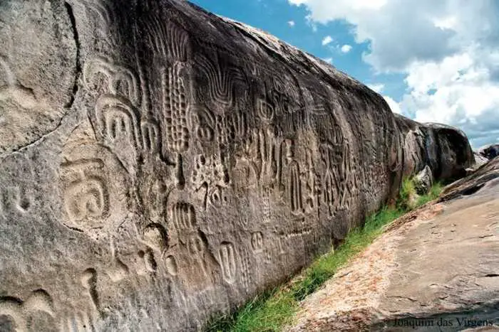
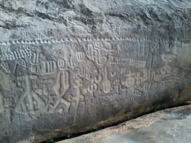
The Inga Stone. Image credit Wikipedia

All over the world, experts have found countless puzzling monuments, artifacts, and places that have remained a mystery ever since their discovery. Some of these findings literally rewrite history as we know it.


Countless theories have been proposed throughout the years trying to explain some of them, however, not even the best scholars can agree on the purpose, reason and building process of some of these sites/structures.

In this article, we take a look at FIVE discoveries that still continue to baffle experts

Stonehenge

Stonehenge-an-incredible-neolithic-mystery - 5 Archaeological discoveries no one can explain

One of the best-known ancient sites—other than the Pyramids of Giza—is without Stonehenge. This prehistoric ancient monument is one of the most famous landmarks on Earth. Curiously, it is also one of the most mysterious.

The intricate set of stones was built around 4,000 years ago and is considered as one of the most impressive feats for primitive man who was able to erect it. Not a single archaeologist has successfully explained how it was built. Interestingly, the how isn’t perhaps as mysterious as the why.

Countless theories have tried explaining the real purpose of Stonehenge, yet experts have still failed to agree on one.

Was Stonehenge an Astronomical observatory? Was it a religious temple? Was it burial site? We still do not know.

Gobekli Tepe

Gobekli-tepe - 5 Archaeological discoveries no one can explain

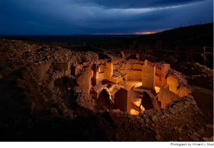
Discovered in 1994, Gobekli Tepe has pushed history to the point of where we need to rewrite everything we thought we knew about our ancestors.

The discovery of Gobekli Tepe has raised countless questions about the evolution of civilization and complex societies that may have existed tens of thousands of years ago.

This ancient site is believed to be at least 12,000 years old, meaning that it predates Stonehenge by around 6,500 years and the Pyramids at Giza by around 7,000 years.

The main structures of Göbekli Tepe are a series of three rectilinear structures which are located below the surface, defined by dry-stone walls, and containing multiple decorated T-shaped pillars. The stones were used mainly as support for the roof, although it cannot be excluded that these had a symbolic purpose.

To date, experts have still NO IDEA who built this massive, fascinating site around 12,000 years ago. Göbekli Tepe is considered the world’s first temple. Most of this ancient site still remains buried. Whoever built it, made sure the complex would survive along thousands of years, by backfilling the various sites and burying them deep under. So far, excavations and geomagnetic results revealed that there are at least 20 stone circles –temples— on the site. All of the pillars at Göbekli Tepe are t-shaped and range in height from 3 to 6 meters.

The Cochno Stone

Cochno-stone - 5 Archaeological discoveries no one can explain

The Cochno Stone is a mysterious, 5,000-year-old slab discovered in 1887 by the Rev. James Harvey. It features around 90 carved indentations, considered to be one of the finest sets of petroglyphs in Scotland. There is no consensus among archaeologists on the meaning of the intricate symbols found on its surface. Is it perhaps a map of the sky or the earth? An altar where rituals were held? According to some experts, represent an ancient cosmic map. The incredible markings are reminiscent of enormous crop circles that have so often been attributed to extraterrestrial civilizations. Interestingly, other similar slabs have been found in the north of Spain, Mexico, Greece and even in India.

The Inga Stone

Foto - 5 Archaeological discoveries no one can explain

Another mind-bending discovery is the so-called Inga Stone discovered in Brazil.

Believed to date back around 6,000 years, stands the Inga Stone, aka Itacoatiara, do Ingá. The Inga stone covers an area of two-hundred and fifty square meters. It is a vertical construction of 46 meters long and up to 3.8 meters high. The Inga stone displays carvings that are even today waiting to be deciphered. Researchers have found several carvings, figures, fruits, animals and other unknown figures, but most importantly carved on the Inga stone are the Milky Way and the constellation of Orion. Archaeologists state that the engravings on the stone have been performed with incredible precision and the details reveal a superb technique used by very skilled artists who certainly were very gifted and capable of creating these amazing engravings.

The MASSIVE Stone structure beneath the Sea of Galilee

galileecrop - 5 Archaeological discoveries no one can explain
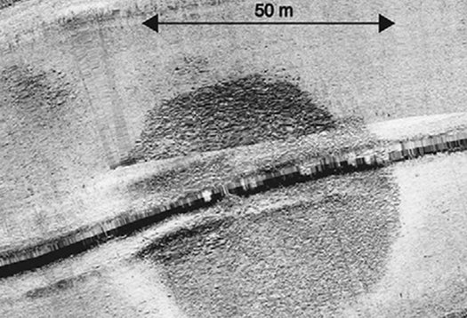
Underwater Cairn Sonar The conical pile of rubble is approximately 70 meters (230 feet) in diameter. Shmuel Marco

Beneath the Sea of Galilee is a MASSIVE mysterious cone-shaped structure made of “basalt stones and uncut boulders”, with a weight of around 60,000 tons according to researchers. Its purpose and origin—like many other ancient structures—remains a profound mystery for experts.

With a height of around 10 meters and a diameter of approximately 70 meters, the structure is a massive mystery. Scientists believe that in order to build a structure like this, its creators had to invest a lot of hours of work in an organized community effort. How they managed to transport the megalithic blocks of stone is a question that no one has been able to explain. Archaeologists argue that judging by what they have been able to see, its builders belonged to a “complex and well-organized society” with “skills in economic planning.”

The Cochno Stone: A massive 5,000-year-old cosmic map?

0

YouTube Video Here: https://www.youtube.com/embed/zKJATmX6wpU?feature=oembed&enablejsapi=1


Cochno-stone - The Cochno Stone: A massive 5,000-year-old cosmic map?
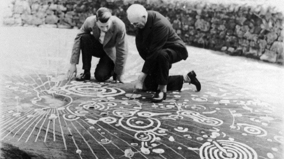
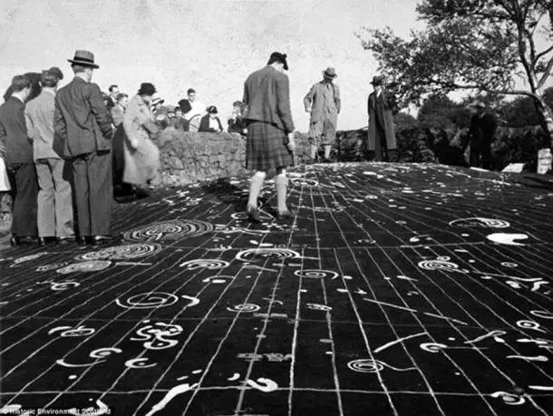
Ludovic Mann (right) analyzed the symbols with an assistant in the 1930’s.

The 5,000-year-old ‘Cochno Stone’ contains around 90 intricate spirals and intentions that according to some authors, represent an ancient cosmic map. Discovered in 1887, the mystery stone remained buried for decades in order to protect it from vandalism.


One of the most fascinating archaeological mystery is the discovery of the so-called Cochno stone.

Discovered in 1887 by the Rev. James Harvey, the ancient stone measures 13 meters by 7.9, and features around 90 intricate carvings—considered as one of the finest sets of petroglyphs in Scotland—which according to many researchers represent a cosmic map, detailing planets and stars.

After its discovery, in 1965 archaeologist Ludovic Maclellan Mann decided to bury the massive slab under several feet of soil to protect it from further damage and to prevent people from adding their own carvings onto it.

So far, archaeologists cannot agree on what is exactly depicted on the massive slab.


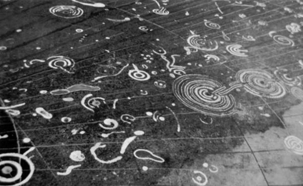
cochno-stone- - The Cochno Stone: A massive 5,000-year-old cosmic map?
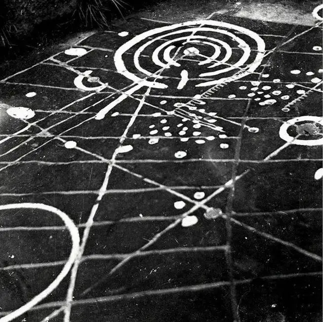
Detail of cup and ring markings on the Cochno Stone. Image credit: Royal Commission on the Ancient and Historical Monuments of Scotland.

There is no consensus among archaeologists on the meaning of the intricate symbols found on its surface. Is it perhaps a map of the sky or the earth? An altar where rituals were held?

Some have proposed that the slab is in fact a portal, of life and death, symbolizing rebirth.

Some archaeologists theorize that the intricate drawings of domes, lines, and rings, are an ancient expression of rock art that has been found in many parts of the world.

According to experts, the symbols date back to the Neolithic and early Bronze Age but there are some examples that have been found to date from the Iron Age.

Researcher Alexander McCallum proposed that the Cochno Stone is a map showing other settlements in the Clyde Valley.

The incredible markings are reminiscent of enormous crop circles that have so often been attributed to extraterrestrial civilizations. Interestingly, other similar slabs have been found in the north of Spain, Mexico, Greece and even in India.


Cochno-stone- - The Cochno Stone: A massive 5,000-year-old cosmic map?
The Cochno stone. Image credit: Historic Environment Scotland.

Even today it remains a complete mystery as to what messages the stone contains. The intricate drawings can be tribal symbols, border boundary signs (such as on a map), representations of the cosmos or slits containing liquids in ritual celebrations, among hundreds of other proposed explanations.

They may also be simply decorative forms, an interpretation that could be the most revolutionary of all because it would in a way ‘connect’ prehistoric humans to abstract artists of the twentieth century.

The mystery engulfing the Cochno stone continues. Little is known about what the intricate marks symbolize, but they are found in many rock art sites around Europe.


Cochno-stone- - The Cochno Stone: A massive 5,000-year-old cosmic map?
Experts are still not sure what the mystery symbols represent.

Experts plan to digitally map the stone and that data obtained could shine more light on its history, its purpose and the people who created the artwork around 5,000 years ago.

Dr. Kenny Brophy, from the University of Glasgow, who specializes in urban archaeology, lead the excavation and described the experience of seeing the stone for the first time in 51 years as a “once in a lifetime opportunity”.

“The Cochno Stone is something I had heard about as a boy, historically it is well documented, but I was not able to see it until now.”

Scientists find life may have existed 3.8 Billion years ago

0

Oldest-life-on-Earth - Scientists find life may have existed 3.8 Billion years ago
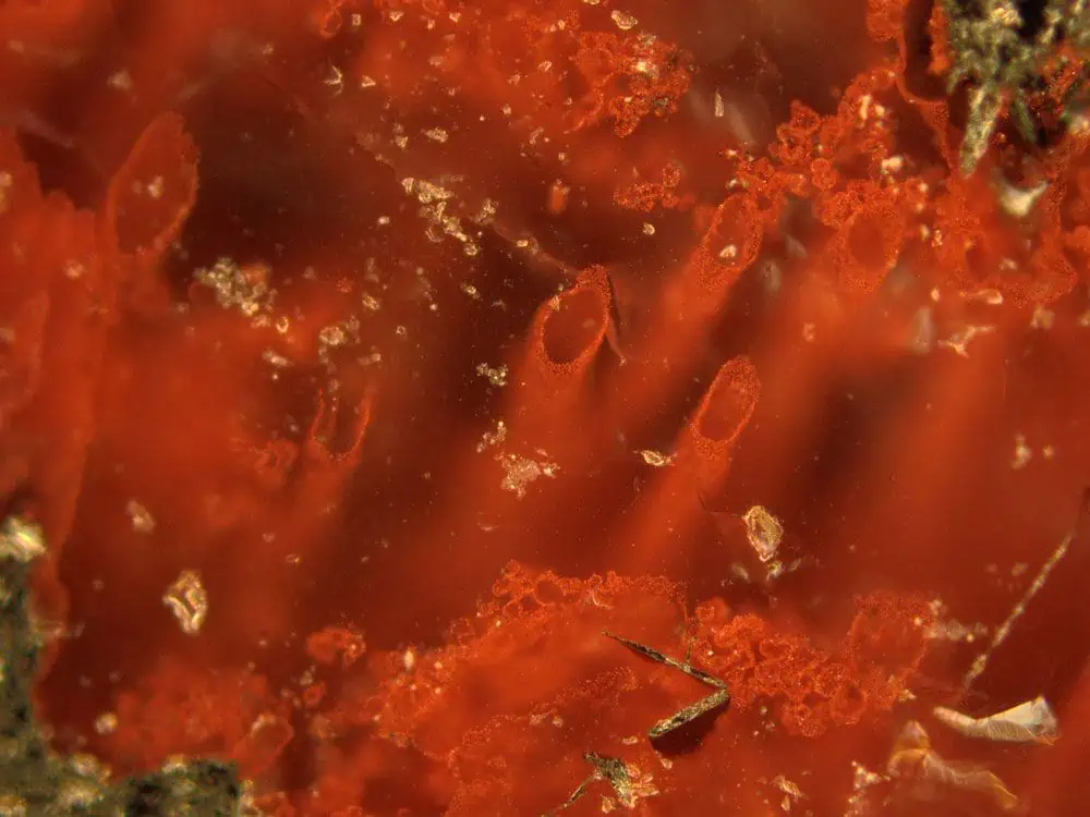
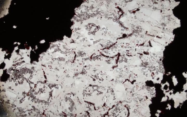
The microscopic filaments and tubes, composed of an iron oxide called hematite, appeared within a rock type called jasper.

A group of researchers says life on Earth begun much sooner after discovering 3.8 billion-year-old microbes. 

Scientists have revealed the EARLIEST life on our planet: the 3.8 billion-year-old microbes have changed a lot about life on Earth, and offer hopes of finding life on other planets like Mars.


According to researchers, life on Earth may have begun much sooner than previously thought. Experts have found evidence of the EARLIEST life ever in 3.8 Billion-year-old fossil microbes in Canada’s ancient sea floor. The discovery of microbes suggests that life could rise from marine hydrothermal sources shortly after the formation of the planet.


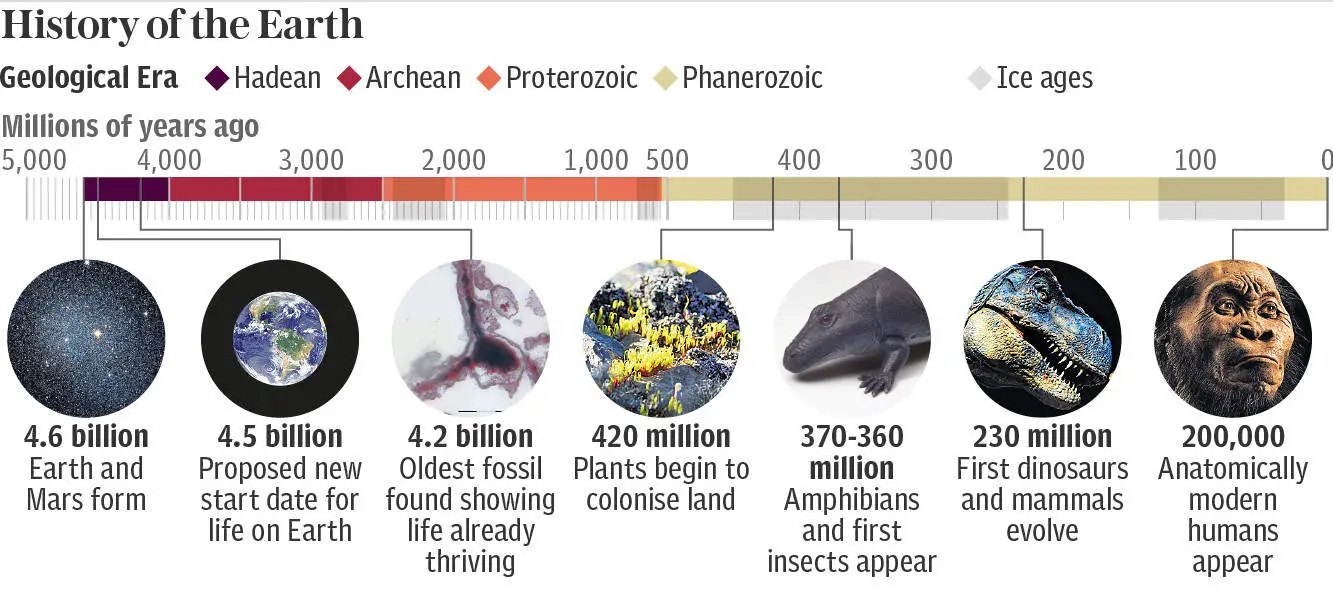
Timeline - Scientists find life may have existed 3.8 Billion years ago


Not long ago, a study published in the prestigious journal Nature revealed the discovery of 3.7 billion-year-old fossilized microorganism which were found Greenland. The finding had anticipated by 220 million years the oldest evidence of life on Earth.

Now, the new discovery pushes the timeline further back as experts have discovered in Canada’s seafloor fossilized microorganisms which existed on earth nearly 3.8 billion years ago.


Although it is not known when or where life on Earth began, some of the earliest habitable environments may have been submarine-hydrothermal vents. Here we describe putative fossilized microorganisms that are at least 3,770 million and possibly 4,280 million years old in ferruginous sedimentary rocks, interpreted as seafloor-hydrothermal vent-related precipitates, from the Nuvvuagittuq belt in Quebec, Canada. These structures occur as micrometre-scale haematite tubes and filaments with morphologies and mineral assemblages similar to those of filamentous microorganisms from modern hydrothermal vent precipitates and analogous microfossils in younger rocks. The Nuvvuagittuq rocks contain isotopically light carbon in carbonate and carbonaceous material, which occurs as graphitic inclusions in diagenetic carbonate rosettes, apatite blades intergrown among carbonate rosettes and magnetite–haematite granules, and is associated with carbonate in direct contact with the putative microfossils. Collectively, these observations are consistent with an oxidized biomass and provide evidence for biological activity in submarine-hydrothermal environments more than 3,770 million years ago.


The microorganism were discovered by an international team of scientists in the so-called Nuvvuagittuq belt, along the eastern shore of Hudson Bay in northern Quebec. The Nuvvuagittuq belt is a fragment of our planet’s early oceanic crust and is composed of basaltic rocks preserving pillow lava structures ‘consistent with a submarine setting,’ according to the researchers of the study. To make the discovery scientists inspected jasper rocks, which are believed to be from ancient hydrothermal vents. Scientists studied tubes and filaments which were found to be preserved in rocks that resemble similar structures which experts attribute to bacterial life see in other seafloor hydrothermal environments.


Oldest-life-on-Earth- - Scientists find life may have existed 3.8 Billion years ago
A microscopic image of one of the earliest lifeform ever found CREDIT: DOMINIC PAPINEAU

The new finding not only suggests that life could have arisen and colonized the sea soon after the formation of our planet, but perhaps other worlds—similar to ours—may have had the same characteristics were life may have come into existence.

Scientists say that this discovery also points to the possibility that life—as we know it—may lurk on Mars.

Because the fossils are nearly as old as our planet—Earth formed around 4.5billion years ago—the discovery supports previous studies that life on Earth may have formed in very extreme environments said Matthew Dodd of University College London (UCL), who led the study.

“Modern hydrothermal vent deposits host communities of microorganisms, some of which are iron-oxidising bacteria that form distinctive tubes and filaments,” wrote experts in the study.

“Epifluorescence imaging [microscopes that use fluorescence to generate an image] of modern vent samples has shown that cylindrical casts composed of iron oxyhydroxide are formed by bacterial cells and are undeniably biogenic. Hence, morphologically similar tubes and filaments in ancient jaspers may be taken as biosignatures that can survive elevated temperatures and pressures.”


Oldest-life-on-Earth- - Scientists find life may have existed 3.8 Billion years ago
A section of the rock showing the tiny fossils inside CREDIT: DOMINIC PAPINEAU

But perhaps the most important thing is that scientists believe that this discovery gives hopes of finding life on other planets and moons.

Professor Dodd added: “These discoveries demonstrate life developed on Earth at a time when Mars and Earth had liquid water at their surfaces, posing exciting questions for extra-terrestrial life. Therefore, we expect to find evidence for past life on Mars 4,000 million years ago, or if not, Earth may have been a special exception.”

However, there are scientists who remain unconvinced. One such scientist is Roger Buick, a professor in Earth and Space Sciences at the University of Seattle.

“I’m rather dubious that this finding will stand up to further scientific scrutiny.”

“Where’s the organic carbon in the filaments (rather than adjacent to them), where’s the internal (rather than external) carbon isotope data supporting biological carbon fixation, where’s the evidence of cellularity, where’s the evidence of behavior?”

“This study seems to have been held to a lower burden of proof than other microfossil reports and fails to meet the standards that would be required for a younger microfossil claim to be accepted. Possible, but not probable, and certainly not persuasive or compelling.”


Source: Evidence for early life in Earth’s oldest hydrothermal vent precipitates

Ancient texts reveal a black Pyramid is missing at the Giza plateau

0

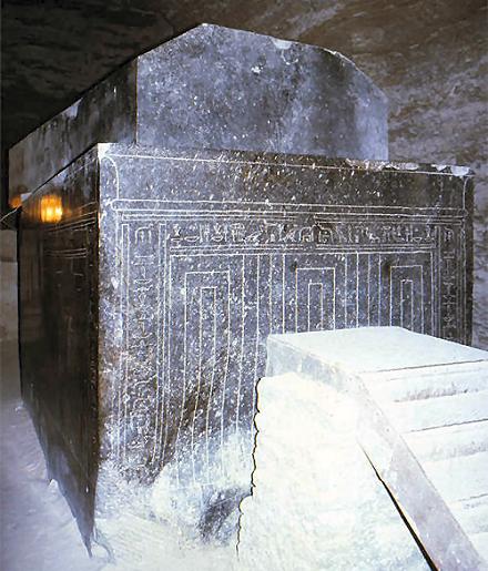
Black-Pyramid - Ancient texts reveal a black Pyramid is missing at the Giza plateau


The three major pyramids at the Giza plateau are perhaps the most famous trio of pyramids on the surface of the planet. But, according to ancient texts, there was a fourth MAJOR pyramid at Giza, made of a stone more black than the common granite and its summit ends in a single great stone which seems to have served as a pedestal. The summit is made of a yellowish stone. 


According to a Danish naval captain and explorer, there was a fourth BLACK PYRAMID at Giza, which made the already trio of Pyramid look even more impressive.

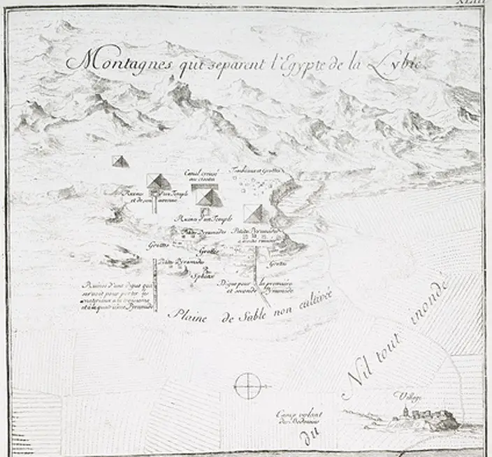
During the 1700’s, Frederic Norden made extensive notes, observations, and drawings of everything around him, including people, pharaonic monuments, architecture, installations, maps, etc., All of which was published in the posthumous Voyage d’Egypte et de Nubie.

You can download the copy of the book below.

Frederic Norden was a Danish explorer, and author of the book ” Travels in Egypt and Nubia “. In a text published after his death, the author recounts the discoveries and shares detailed drawings of his expedition to Egypt, undertaken at the request of King Christian VI of Denmark in 1737.

Particular data mentioned in the texts has continued to fascinate researchers: the author mentions a glorious BLACK Pyramid located at the Giza Plateau.

However, many scholars argue such pyramid never existed and that the Danish explorer might have confused some of the secondary monuments of Giza for a fourth pyramid. Some even argue that Norden may have confused some of the satellite pyramids around the three main monuments for the fourth Pyramid, however, this is contradictory as Norden precisely describes the Pyramid being made of a stone BLACKER and HARDER than granite. The satellite pyramids are all made of sandstone.


Fourth-Pyramid-of-Giza - Ancient texts reveal a black Pyramid is missing at the Giza plateau


Nevertheless, the maps made by Norden seem to contradict this hypothesis as they clearly show four major Pyramid at the Giza plateau.

Today experts have still not found traces of a major ‘black Pyramid’ at the Giza plateau, but that doesn’t mean it wasn’t there. There are some authors who suggest that this lost pyramid was in fact destroyed in the late eighteenth century, and the Pyramids stones were utilized in the construction of the city of Cairo.

On page 120 of his book Voyage d’Egypte et de Nubie (Travels in Egypt and Nubia) Norden describes the mysterious Pyramid:


“The principal pyramids are at the east, south-east of Gize …..There are four of them; that deserve the greatest attention of the curious,; for tho, we see seven or eight others in the neighborhood, they are nothing in comparison to the former. ……. ……..The two most northerly pyramids are the greatest and have five hundred feet perpendicular height. The two others are much less, but have some particularities, which occasion their being examined and admired.”

It is s without coating, closed and resembles the others, but without any temple like the first. It has, however, one particular deserving remark; which is, that its summit is terminated by a single great stone, which seems to have served as a pedestal…the fourth pyramid has been made, upwards above the middle, of a stone more black than the common granite, and at least as hard. Its summit is of a yellowish stone. I shall speak elsewhere of its top, which terminates in a cube. It is, moreover, situated out of the line of the others, being more to the west…it makes a series with the three others.”


So, where is this majestic Pyramid? Is it perhaps buried along with the numerous secrets of ancient Egypt? WE know for a fact that there are numerous structures that still remain hidden beneath the ground. Perhaps the remains of this majestic pyramid are also located hidden underground, waiting for the day someone lucky enough will stumble across its glorious foundation, revealing to the world that Ancient Egypt is still filled with mystery and that we are on a long journey to discover the real history of Egypt.

You can download a copy of the book here.

Scientists use mathematical calculations to prove God is real

0

Proof-of-God - Scientists use mathematical calculations to prove God is real


It seems that Scientists have supposedly confirmed the existence of ‘God’ after ‘proving’ a mathematician’s theory which suggests a ‘HIGHER POWER’ exists.


According to two scientists, they may have proven –once and for all— that there is a –holy- force out there, after confirming complex mathematical equations.

Around 1941, Mathematician Kurt Gödel created a long and complex theory based on MODAL LOGIC. Called Gödel’s ontological proof it presupposes the notion of positive and negative properties, and proves the necessary existence of an object which each positive property, but no negative property, applies to.

Gödel’s theory is based on mathematical equations which are very sophisticated, but as most things in history, they are based on far more ancient ‘models’.

Gödel’s ontological proof is a modern version of the ontological argument for the existence of God of St. Anselm of Canterbury (1033-1109), a Benedictine monk who was archbishop of Canterbury from 1093 until his death.

His argument, in summary is the following: “By definition, God is that from which nothing greater can be conceived. If such a being fails to exist, then a greater being—namely, a being than which no greater can be conceived, and which exists—can be conceived. But this would be absurd: nothing can be greater than a being than which no greater can be conceived. So a being than which no greater can be conceived—i.e., God—exists.

The essence is that no greater power than God can be conceived, and if he or she is believed as a concept then he or she can exist in reality.

Many of the demonstrations –such as those written above— are based on assigning the concept of “God” a maximum property. Gödel’s demonstration, on the other hand, tries to use a minimal argument, so it focuses on the “essence” of the positive properties that characterize God.

https://www.youtube.com/watch?v=NZI5_0QCgj0

Gödel’s Ontological Argument as interpreted by Anderson, 1990:

Definition 1: x is God-like if and only if x has as essential properties those and only those properties which are positive

Definition 2: A is an essence of x if and only if for every property Bx has B necessarily if and only if A entails B

Definition 3: x necessarily exists if and only if every essence of x is necessarily exemplified

Axiom 1: If a property is positive, then its negation is not positive.

Axiom 2: Any property entailed by—i.e., strictly implied by—a positive property is positive

Axiom 3: The property of being God-like is positive

Axiom 4: If a property is positive, then it is necessarily positive

Axiom 5: Necessary existence is positive

Axiom 6: For any property P, if P is positive, then being necessarily P is positive.

Theorem 1: If a property is positive, then it is consistent, i.e., possibly exemplified.

Corollary 1: The property of being God-like is consistent.

Theorem 2: If something is God-like, then the property of being God-like is an essence of that thing.

Theorem 3: Necessarily, the property of being God-like is exemplified.

Proof-of-God - Scientists use mathematical calculations to prove God is real
The ontological proof of Gödel in mathematical notation.

Easy , right?

Well, two computer scientists may have proven that such complicated equation odes indeed add up, and God is real.

The two computer scientists argue that they were not directly trying to prove –nor disprove— the existence of God, but only showcase the power of their computers.

Speaking to Spiegel Online, Christoph Benzmüller of Berlin’s Free University, who ran the calculations along with Bruno Woltzenlogel Paleo of the Technical University in Vienna said:

“It’s totally amazing that from this argument led by Gödel, all this stuff can be proven automatically in a few seconds or even less on a standard notebook.

“I didn’t know it would create such a huge public interest but [Gödel’s ontological proof] was definitely a better example than something inaccessible in mathematics or artificial intelligence…

“It’s a very small, crisp thing, because we are just dealing with six axioms in a little theorem.

“There might be other things that use similar logic.”

Ultimately, the formalization of Gödel’s ontological proof is unlikely to win over many atheists, nor is it likely to comfort true believers.


Featured image: Getty

Reference:

Ontological ArgumentsStanford Encyclopedia of Philosophy.

Formalization, Mechanization and Automation of Gödel’s Proof of God’s Existence

30 bewildering facts about Akhenaten—ancient Egypt’s most controversial Pharaoh

0

Akhenaten - 30 bewildering facts about Akhenaten—ancient Egypt’s most controversial Pharaoh


Akhenaten was one of ancient Egypt’s most influential and controversial pharaohs. He is considered one of the world’s most important religious innovators.

He was a Pharaoh of the Eighteenth dynasty and he was the father of Tutankhamun, husband to Queen Nefertiti. Akhenaten claimed to be a direct descendant of Aten and regarded himself to be divine and was himself a God. He is one of the most interesting and mysterious rulers of Ancient Egypt, and here’s why:

Akhenaten was a Pharaoh of the Eighteenth dynasty of Egypt and ruled for 17 years.

Akhenaten was known as the “great heretic” due to his religious innovations.

Akhenaten was the son of Amenhotep III and Queen Tiye.

Early on in his reign, he was known as Amenhotep IV, but he changed his name to Akhenaten to reflect his close link with the new supreme deity of his making.

He was also known as `Akhenaton’ or `Ikhnaton’ and also `Khuenaten’, all of which are translated to mean `successful for’ or `of great use to’ the god Aten.

Akhenaten was married to Queen Nefertiti, one of the most famous of all ancient Egyptian women.

Nefertiti was one of the most influential queens. Paintings show her conducting religious ceremonies with Akhenaten as an equal. However, she wasn’t Akhenaten’s only wife. Kiya was also wife to Akhenaten. Little is known about her, and her actions and roles are poorly documented in the historical record.

Nefertiti’s mummy was never found. Archaeologist June Fletcher claimed she found Nefertiti’s badly-mutilated mummy in a side chamber of the Tomb of Amenhotep II in the Valley of the Kings. Most scholars are not convinced.

Akhenaten was father of both Tutankhamun (by a lesser wife named Lady Kiya) and Tutankhamun’s wife Ankhsenamun (by Nefertiti).

These are Akhenaten’s children (known and theoretical) with suggested years of birth: Smenkhkare — year 35 or 36 of Amenhotep III’s reign Meritaten — year 1. Meketaten — year 3, possibly earlier. Ankhesenpaaten, later Queen of Tutankhamun — year 4. Neferneferuaten Tasherit — year 8. Neferneferure — year 9. Setepenre — year 9. Tutankhaten — year 8 or 9 — renamed Tutankhamun later.

Archaeologists and historians believe that Akhenaten may have taken some of his daughters as sexual consorts, to attempt to father a male heir by them.

Akhenaten ordained new priests, or simply forced priests of Amun into the service of his new monotheism, and proclaimed himself and his queen gods.

Akhenaten elevated Nefertiti to divine status. Scholars suggest that she may have been only 12 when married to Akhenaten.

Akhenaten halted foreign military campaigns and dramatically scaled down Egypt’s military defenses.

He is noted for abandoning traditional Egyptian polytheism and introducing worship centered on the Aten.

Akhenaten claimed, “There is only one god, my father. I can approach him by day, by night.”

Akhenaten could have been the first monotheist in all of history.

According to Egyptian Mythology, he descended from the gods who arrived on Earth at the time of Tep Zepi.

“By the ninth year of his reign, Akhenaten had proscribed the old gods of Egypt, and ordered their temples to be closed, a very serious matter, for these institutions played an important part in the economic and social life of the country.”—historian Barbara Watterson

Akhenaten, upon becoming Pharaoh ordered all the iconography of previous gods to be removed.

At some point after his fifth regnal year, Akhenaten initiated a program to erase the name and image of the Theban god, Amon, from all monuments.

According to writings by Akhenaten and poems that were written about him later on, he was visited by beings that descended from the sky, these beings told Akhenaten what he needed to do and how he needed to rule over his people.

Akhenaten claimed to be a direct descendant of Aten and regarded himself to be divine and was himself a God, but not only did he believe himself to be a god, the whole nation worshiped him like one.

Akhenaten ordered the construction of a new capital—called Amarna—and he dedicated it to the sun.

Amarna’s location was chosen so that its sunrise conveyed a symbolic meaning. “East of Amarna the sun rises in a break in the surrounding cliffs. In this landscape the sunrise could be literally ‘read’ as if it were the hieroglyph spelling Akhet-aten or ‘Horizon of the Aten’ — the name of the new city,” wrote Montserrat in his book “Akhenaten: History, Fantasy and Ancient Egypt” (Routledge, 2000).

Akhenaten instituted changes in art and culture and one of the most notable changes was how he would be publicly depicted, not as a strong “untouchable” Pharaoh, but as he really was, “weak”, elongated skull, long neck, sunken eyes, thick thighs, long fingers, backward-turned knee joints, a potbelly and female-like breasts.

Akhenaten likely suffered from an illness called Marfan’s Syndrome. Other possibilities have been suggested including elephantiasis and Froelich’s Syndrome.

After his reign the city of Amarna was abandoned and temples to the sun were destroyed, images of Akhenaten were deliberately defaced.

In 1907, British archaeologist Edward Ayrton made headlines ‘finding’ the actual mummy of Akhenaten in Egypt’s Valley of the Kings. It has long been speculated, as well as much-disputed, that the body found in this tomb was that of the famous Pharaoh Akhenaten. Results of genetic and other scientific tests published in February 2010 have confirmed that the person buried there was both the son of Amenhotep III as well as the father of Tutankhamun.

The last dated appearance of Akhenaten and the Amarna family is in the tomb of Meryra II, and dates from the second month, year 12 of his reign.

Newly found sunken continents suggests the mythical continent of Lemuria was real

0

YouTube Video Here: https://www.youtube.com/embed/o61P6ysKklM?feature=oembed&enablejsapi=1


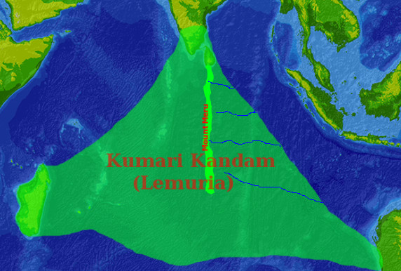
Lost-Continent-of-Kumari-Kandam - Newly found sunken continents suggests the mythical continent of Lemuria was real


Scientists have discovered at least TWO sunken continents on Earth. The discovery of these continents has changed the way we look at Earth’s history, offering new evidence which many authors have interpreted as material which points to the fact that the mythical continents such as Lemuria, Mu, and Atlantis were real.


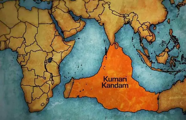
Most of us are familiar with the legends of Atlantis, Lemuria, and Mu. According to numerous legends and texts, Earth was home to numerous continents which have been ‘lost’ in the distant past. One of them is the continents of Lemuria, a massive landmass which is said to have stretched from India to Australia—before written history.

Just like Atlantis, the ancient landmass disappeared under mysterious circumstances and was forgotten by mankind tens of thousands of years ago.

During the 19th century, an English geologist called Philip Sclater mentioned the existence of a submerged landmass called Lemuria.

In an article—dubbed ‘The Mammals of Madagascar’—written in 1864, Sclater mentioned that lemur fossils were extremely abundant in Madagascar and India, but curiously, these fossils were missing in Africa and the middle East. This observation led Sclater to propose that during one point in the distant past, India and Madagascar were part of a broader continent referred to as Lemuria.

There are numerous studies which have proven recently—despite the idea of continental drift—that submerged continents exist on Earth.

Recently, scientists have made an incredible discovery east of Australia: A continent which has around 5 MILLION square kilometers, and it’s been hiding in plain sight for AGES. Only a small part of the continent—around 5 per cent—is visible today.

Experts suggest that today, only 5 percent of the once-mighty continent is visible, which is why researchers missed it in the distant past.

The region is mostly submerged land in the Pacific Ocean and contains both New Zealand and the French overseas territory New Caledonia.


KumariKandammap - Newly found sunken continents suggests the mythical continent of Lemuria was real
“Lemuria” in Tamil nationalist mysticist literature, connecting Madagascar, South India and Australia (covering most of the Indian Ocean). Image Credit.

“This is not a sudden discovery, but a gradual realization; as recently as 10 years ago we would not have had the accumulated data or confidence in interpretation to write this paper,” the researchers wrote in GSA Today, a journal of the Geological Society of America.

But there is more evidence which hints that submerged continents exist on Earth.

If we take a look at an area between mainland India and Sri Lanka, we will notice a curious geological formation.

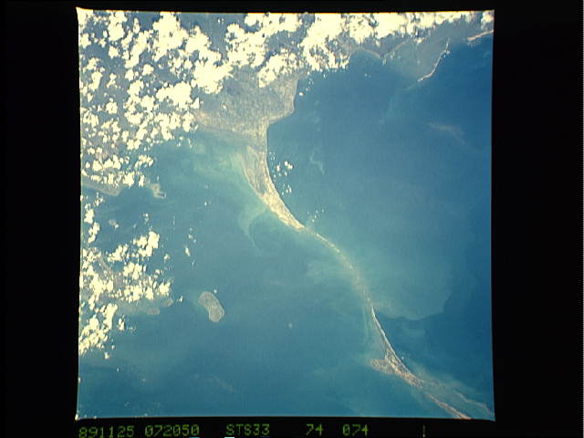
Located in the Palk Strait, in the Indian Ocean, there is a particular geographical area, a thin strip of land that connects the south of India with Sri Lanka. It is called “Adam’s Bridge”.

Adam’s Bridge is believed to be the remains of an ancient pre-flood bridge. Possibly, the first ever bridge built on Earth.

Furthermore, it is believed that satellite images provided by NASA reveal that what we see could in fact be a collapsed bridge, now partially submerged under the ocean.

Dr. Badrinarayanan, the former director of the Geological Survey of India performed a survey of this structure and concluded that it was man-made. Dr. Badrinarayanan and his team drilled 10 bore holes along the alignment of Adam’s Bridge. What he discovered was startling. About 6 meters below the surface he found a consistent layer of calcareous sandstone, corals, and boulder like materials. His team was surprised when they discovered a layer of loose sand, some 4-5 meters further down and then hard rock formations below that.

A team of divers went down to physically examine the bridge. The boulders that they observed were not composed of a typical marine formation. They were identified as having come from either side of the causeway. Dr. Badrinarayanan also indicates that there is evidence of ancient quarrying in these areas. His team concluded that materials from either shore were placed upon the sandy bottom of the water to form the causeway. (Source)

According to Hindu tradition, this “strip of land” is a bridge built by Hindu god Rama, as told in the Hindu epic Ramayana. In fact, since ancient times it is known as the “Bridge of Rama” or “Rama Setu”.


adamsb2
Adam’s Bridge as seen from Space. Image credit: NASA

The Indian epic Ramayana tells the story of the land bridge and how it was built to serve Hindu god Rama, in order to help him cross the water to reach the large island and rescue his beloved one from the clutches of the demon king Ravana. It is a story of love, brave deeds and incredible constructions as it seems. Rama is one of the most famous manifestations of the Supreme God and is recognized as the image, the spirit, and consciousness of Hinduism, one of the oldest religions in the world.

The stories which are many times interpreted as facts of Rama’s life are narrated in the Ramayana, an ancient Sanskrit epic, literally translated to “Rama’s Journey,” which speaks of a time when gods aboard ships (Vimanas) and giants walked the earth. Evidence of the Vimana and the giants have been found across the globe, in different countries.

Evidence of lost continents and ancient civilizations?

According to researchers, the Lemurian continent separated from the mainland sometime during the Mesozoic era because of the rising waters. Curiously, according to India’s National Institute of Oceanography, sea levels were around 100 meters lower some 15,000 years ago.

This resulted in a major flood which eventually led to the disappearance of not only an entire continent but entire civilizations that existed on Earth in the distant past.

According to Tamilnet, the continent of Lemuria is referred as “Kumari Kandam” in ancient Tamil literature.

Tamil is one of the world’s classical languages.

Tamil has continuous historical records for more than 2000 years and the Tamil language was recognized as a classical language in India (beside the other being Sanscrit).

Tamil does not belong to the Indo-European language family.

“One can imagine the strength and magnitude of the Tidal wave required to devour a mountainous area that had existed in the ancient coastal belt of the Tamil world,” says professor Shanmugathas.

The ancient continent of Kumari Kandam is said to have existed south of modern-day India, now below the Indian Ocean. Its people the Tamil are said to have spread across the world creating other civilizations after Kumari Kandam disappeared. There are several names by which the continents goes depending on spelling it can vary from Kumari Kandam, Kumarikkantam, and Kumari Nadu. The word ‘Kumari Kandam’ was first mentioned in a 15th-century version of the Skanda Purana –the largest Mahāpurāṇa, a genre of eighteen Hindu religious texts— and was written by Kachiappa Sivacharyara (1350-1420).

Interestingly, many authors indicate that the people of Tamil belong to the oldest civilization on the surface of the planet and when the continent of Kumari Kandam was lost to the sea, its people migrated to other parts of the planet founding different civilizations.

Lost continents: once a myth now a reality

An ancient continent that was once located between India and Madagascar has recently been found scattered on the bottom of the Indian Ocean. According to experts, three billion years ago, a continent covered the ocean where the East African island of Mauritius now lies.

Experts came to this conclusion after analyzing small fragments of minerals which date back 3,000 MILLION years. In some of the rocks of the island of Mauritius, home of the republic of the same name, you can find small fragments of minerals that are about 3,000 million years old. This would not have to be important, were it not because the young island, of volcanic origin, is barely seven to ten million years old? So where did the pieces of rock come from, and how is it possible that they are so old?

According to experts their origin lies in a “lost continent” located under the island, as researchers from the University Witwatersrand (South Africa) explained in a statement.

What do you think? Is it possible that tens of thousands of years ago—perhaps even further back in history, ancient civilizations lived on continents like Atlantis, Mu and Lemuria?

Recent studies have proven that in the distant past, Earth’s landmass was much different than it is today, one of the main reasons why numerous authors and researchers argue it’s not ludicrous to think that ancient civilizations like Atlantis existed somewhere on Earth.


Reference:

Scientists have found a long-lost ancient continent submerged beneath the ocean

Scientists have found a NEW 5-million-square-kilometer Continent hiding in plain sight

15 Things you should know about the lost continent of Kumari Kandam

The Lost Continent of Kumari Kandam

Sclater, Phillip L., 1864, ‘The Mammals of Madagascar.’ Plate opp. P. 213.

Catastrophes of the past: poetic exaggeration or scientific facts?

Don't Miss

EVEN MORE NEWS

Ads Blocker Image Powered by Code Help Pro

Ads Blocker Detected!!!

We have detected that you are using extensions to block ads. Please support us by disabling these ads blocker.